
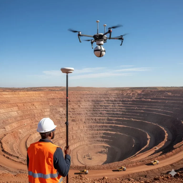
Precision Geomatics and Mapping Technology for Africa’s Large-Scale Development
Choosing between LiDAR vs traditional surveying is a critical decision for any modern infrastructure project. While both methods offer unique benefits, understanding their core differences in speed and accuracy is essential for choosing the best mapping technology for South African civil engineering projects.
In the fast-paced world of African infrastructure—from new highway interchanges in Gauteng to massive mining developments in the Copperbelt or Limpopo—selecting the right surveying methodology can make or break a project’s timeline.
While traditional surveying remains a cornerstone of the industry, LiDAR (Light Detection and Ranging) has emerged as a game-changer for large-scale data acquisition. But which one is right for your specific site? At Trail Surveys, we specialize in both, providing an operational footprint that supports projects across the SADC region and the broader continent.
1. The Case for LiDAR: Speed and Density
LiDAR uses rapid laser pulses to map the environment, creating a “point cloud” that consists of millions of data points.
- Best for: Large-scale topographic surveys, heavily wooded areas, and complex infrastructure like power lines or bridges.
- The Advantage: LiDAR can “see” through vegetation to capture the true bare earth (DTM), which is nearly impossible for traditional methods or standard aerial photography.
- Efficiency: Mapping a 50km road corridor that would take weeks with a Total Station can be completed in days—or even hours—using UAV LiDAR or Mobile Scanning.
2. The Case for Traditional Surveying: Precision and Detail
Traditional surveying involves using Total Stations and GNSS (Global Navigation Satellite Systems) to measure specific points manually.
- Best for: High-precision construction staking, cadastral boundary work, and small sites where “millimetre accuracy” is non-negotiable.
- The Advantage: While LiDAR provides massive volume, traditional surveying provides high-precision data on specific, critical points like bridge bearings or curb heights.
- Cost-Effectiveness: For small, localized projects in urban hubs like Johannesburg or Cape Town, the mobilization costs of advanced LiDAR equipment may not be justified.
Comparison at a Glance: LiDAR vs. Traditional
Feature | LiDAR Surveying | Traditional (Total Station/GNSS) |
Speed | Extremely High (Large areas) | Moderate (Point-by-point) |
Accuracy | High (5-10cm) | Ultra-High (1-5mm) |
Vegetation | Penetrates canopy to ground | Limited to line-of-sight |
Deliverables | 3D Point Clouds / Digital Twins | 2D/3D CAD Drawings |
Best Use | Corridors, Mining, Large Topo | Site Layout, Structures, Boundaries |
3. The Hybrid Approach: The Trail Surveys Standard
For the most ambitious African projects, the answer isn’t “one or the other”—it’s both. At Trail Surveys, we often use LiDAR to capture the vast landscape and traditional GNSS to establish high-precision control points.
This hybrid method ensures you get the speed of modern tech with the legal and technical certainty required for complex infrastructure. Our experience navigating the logistical challenges of remote sites in Zambia, Botswana, and the DRC allows us to deploy these technologies effectively anywhere on the continent.
Conclusion: Making the Right Choice
Choosing between LiDAR and traditional surveying depends on your project’s scale, budget, and accuracy requirements. Trail Surveys provides the professional geomatics consultancy needed to navigate these technical choices, ensuring your project begins with the most efficient data foundation possible.
From Mpumalanga coal fields to infrastructure projects in the Western Cape, we assist in defining the scope of work that yields the best ROI.
Expert Tech Note: The African Context
When surveying in remote African locations, signal disruptions and logistical hurdles are common. We mitigate these by using multi-constellation GNSS receivers (supporting GPS, GLONASS, and Galileo) and hybrid LiDAR-SLAM systems that function even in areas with poor satellite coverage.

How can we help you?
Trail Surveys offers comprehensive land surveying, topographic mapping, and geomatics solutions across various sectors. Contact us today via phone, email, or our website, and one of our expert surveyors will promptly get in touch for a personalized consultation.