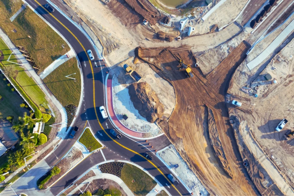
Precision Mapping

What Is a Cadastral Survey? Purpose, Process, and Importance

Powerful Guide to the Surveyor General: Roles, Duties, and Importance in Land Management

What Is a Cadastral Survey? Purpose, Process, and Importance A cadastral survey is the foundation of land ownership and land registration. Whether you’re investing in property, undertaking a residential or commercial development, or resolving boundary disputes, it is vital to understand how cadastral surveys support land governance. In South Africa, cadastral surveys are legally required […]

Powerful Guide to the Surveyor General: Roles, Duties, and Importance in Land Management Read More »

difference between geomatics and land surveying

The Difference Between Geomatics and Land Surveying Explained

The Difference Between Geomatics and Land Surveying Explained Many people use the terms geomatics and land surveying interchangeably. However, while they are connected, they are not the same. Understanding the difference between geomatics and land surveying is important if you’re planning a project that involves mapping, data analysis, or property development. In this article, we

The Difference Between Geomatics and Land Surveying Explained Read More »

site surveyor using survey equipment on construction site

What Does a Site Surveyor Do? Understanding the Role, When to Hire One, and Why It Matters

What Does a Site Surveyor Do? Understanding the Role, When to Hire One, and Why It Matters Before any development or construction begins, you need accurate land data. This is where a site surveyor becomes essential. They provide the insights needed to plan, design, and build with confidence. If you’re considering a land purchase, planning

What Does a Site Surveyor Do? Understanding the Role, When to Hire One, and Why It Matters Read More »

Cadastral Survey South Africa

When and Why, You Need a Cadastral Survey in South Africa: Legal, Development & Ownership Insights

When and Why, You Need a Cadastral Survey in South Africa: Legal, Development & Ownership Insights In South Africa—and across Africa—land ownership is a valuable but often complex issue. Whether you’re a homeowner in Kimberley, a developer in Gaborone, or an investor in Johannesburg, understanding your legal property boundaries is critical. That’s where cadastral surveys

When and Why, You Need a Cadastral Survey in South Africa: Legal, Development & Ownership Insights Read More »

Property surveyors South Africa

How Property Surveyors Measure Property Lines: A South African Guide

How Property Surveyors Measure Property Lines: A South African Guide In South Africa, knowing exactly where your property begins and ends is vital—whether you’re a homeowner, developer, or investor. Property lines define legal ownership and development rights. They can also impact real estate transactions significantly. But these lines aren’t always obvious. Fence lines and physical

How Property Surveyors Measure Property Lines: A South African Guide Read More »

hydrographic surveying and environmental conservation

How Hydrographic Surveying Supports Environmental Conservation

How Hydrographic Surveying Contribute to Environmental Conservation Hydrographic surveying and environmental conservation are closely linked in the effort to protect water bodies. With growing threats such as pollution, habitat destruction, and climate change, accurately mapping underwater environments is crucial. Hydrographic surveys provide essential data to monitor marine ecosystems, assess human impact, and guide conservation initiatives.

How Hydrographic Surveying Supports Environmental Conservation Read More »

Understanding Construction Layout Plans

Understanding Construction Layout Plans: A Guide for Builders and Developers

Understanding Construction Layout Plans: A Guide for Builders and Developers Construction layout plans serve as the foundation of any successful building project. These detailed drawings guide builders, engineers, and developers in translating designs into real-world structures. However, interpreting these plans accurately is crucial to ensuring proper execution, avoiding costly errors, and maintaining compliance with regulations.

Understanding Construction Layout Plans: A Guide for Builders and Developers Read More »

Accuracy Drone Surveying

Ensuring Accuracy in Drone Surveys

Ensuring Accuracy in Drone Surveys: Techniques and Best Practices In modern surveying, precision is everything. Industries such as construction, mining, and land development rely on accurate data for informed decision-making. Drone technology has revolutionized this field, but achieving accuracy in drone surveying requires more than just flying a drone. To ensure reliable results, surveyors must

Ensuring Accuracy in Drone Surveys Read More »

3D Scanning is Transforming Precision Farming in South Africa

3D Scanning is Transforming Precision Farming in South Africa

3D Scanning is Transforming Precision Farming in South Africa Agriculture isn’t just an industry in South Africa—it’s a way of life. It puts food on the table, supports millions of families, and drives the economy. But farming is becoming increasingly challenging. Climate change, unpredictable rainfall, soil degradation, and rising input costs are putting immense pressure

3D Scanning is Transforming Precision Farming in South Africa Read More »

Utility Location Technology

Smarter & Safer Underground Utility Locating

Utility Location Technology: Smarter, Safer and More Creative Solutions Before any excavation begins, knowing what’s buried underground is crucial. Hitting an unseen utility can lead to costly damages, project delays, and serious safety hazards. That’s why underground utility locating has become an essential part of construction, engineering, and infrastructure projects. With today’s advanced technology, we

Smarter & Safer Underground Utility Locating Read More »

Scroll to Top