
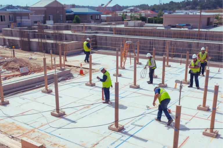
Understanding How Poor Survey Data Undermines Construction Projects
Construction projects rarely fail because of a single mistake. More often, failure begins with inaccurate or incomplete information — and poor survey data is one of the most common root causes.
In South Africa, construction relies on survey data to establish boundaries, levels, control, and layout. When this data is incorrect, outdated, or poorly verified, the consequences can cascade through design, construction, approvals, and legal compliance.
This article explains why construction projects fail due to poor survey data, how these failures occur, and why accurate surveying is essential for successful project delivery.
Why Survey Data Is Foundational to Construction
Survey data provides the spatial reference framework for a construction project. It ensures that:
- Designs align with the physical site
- Buildings are positioned correctly
- Levels and gradients are accurate
- Legal boundaries and servitudes are respected
Once construction begins, most decisions are based on the assumption that the underlying survey data is correct. If that assumption is wrong, every downstream activity is affected.
For an overview of the survey data required before building begins, see:
https://trailsurveys.com/what-survey-data-is-required-before-construction-starts/
Common Ways Poor Survey Data Causes Construction Failure
- Incorrect Building Position and Layout Errors
One of the most frequent consequences of poor survey data is incorrect building placement.
This can occur when:
- Boundary positions are inaccurate
- Control points are incorrectly established
- Layout data is based on unreliable references
The result may be buildings constructed:
- Too close to boundaries
- Outside approved building lines
- Misaligned with site development plans
Layout errors often originate during the setting-out phase. More context on layout accuracy can be found here:
https://trailsurveys.com/understanding-construction-layout-plans/
Correcting layout errors after construction has started is often costly and disruptive.
- Boundary Encroachments and Legal Disputes
Poor survey data can lead to boundary encroachments, where structures extend beyond legal property limits or into servitudes.
These issues may result in:
- Legal disputes with neighbouring property owners
- Enforcement action by authorities
- Requirements to alter or remove structures
Boundary-related errors commonly occur when cadastral data is outdated or not properly verified before construction.
Further reading:
https://trailsurveys.com/the-importance-of-boundary-surveys-for-property-and-development/
- Level and Drainage Failures
Accurate vertical survey data is critical for:
- Floor levels
- Drainage gradients
- Access roads and pavements
Poor survey data can cause:
- Incorrect floor elevations
- Inadequate drainage slopes
- Water pooling or flooding issues
These problems often become visible only after construction is underway, making them expensive to fix.
- Design and Construction Misalignment
When survey data does not accurately reflect site conditions, designs may not translate correctly to the ground.
This misalignment can lead to:
- Structural elements clashing with site constraints
- Inaccurate earthworks quantities
- Repeated design revisions
Reliable topographic and control data are essential to avoid these issues.
Related article:
https://trailsurveys.com/how-advanced-technology-is-revolutionizing-land-surveying/
- Delays, Rework, and Cost Overruns
Poor survey data almost always results in:
- Construction delays
- Rework and corrective measures
- Increased project costs
Even small inaccuracies can escalate on large projects, particularly where multiple contractors rely on the same survey data.
- Compliance Failures and Rejected Inspections
Construction projects must comply with:
- Approved plans
- Zoning conditions
- Building line and setback requirements
If survey data is incorrect, completed work may not comply with approvals, leading to:
- Failed inspections
- Stop-work notices
- Remedial construction requirements
In regulated environments, compliance failures can jeopardise project viability.
For insight into the risks of incorrect surveying, see:
https://trailsurveys.com/what-happens-if-a-land-survey-is-incorrect/
Why Poor Survey Data Occurs
Poor survey data is not always the result of a single error. Common contributing factors include:
- Use of outdated survey information
- Inadequate boundary verification
- Insufficient control point establishment
- Inappropriate survey methods for the site
- Lack of quality control and verification
In many cases, survey data is reused or assumed to be correct without proper validation.
Who Is Affected When Survey Data Is Poor?
The impact of poor survey data extends across the entire project team, including:
- Developers facing delays and increased costs
- Engineers relying on incorrect design inputs
- Contractors forced to redo work
- Property owners exposed to legal risk
- Investors dealing with project uncertainty
Survey accuracy underpins trust and coordination across all stakeholders.
How Accurate Survey Data Prevents Construction Failure
Accurate survey data helps ensure that:
- Construction starts from verified control
- Boundaries and servitudes are respected
- Designs align with real site conditions
- Compliance requirements are met
Early investment in professional surveying significantly reduces risk and improves project outcomes.
Why Professional Surveying Matters in Construction Projects
Professional land surveyors apply:
- Verified control networks
- Appropriate survey methodologies
- Quality assurance checks
- Compliance with statutory requirements
This ensures that survey data is suitable for construction use and reliable throughout the project lifecycle.
Guidance on working with qualified surveyors is available here:
https://trailsurveys.com/working-with-a-land-surveyor-in-southern-africa/
Final Thought
Construction projects fail not only because of poor execution, but often because they start with poor information. Poor survey data undermines accuracy, compliance, and coordination, creating risks that grow as projects progress.
In South Africa’s construction environment, accurate survey data is a critical foundation for successful, compliant, and cost-effective construction projects.

How can we help you?
Trail Surveys offers comprehensive land surveying, topographic mapping, and geomatics solutions across various sectors. Contact us today via phone, email, or our website, and one of our expert surveyors will promptly get in touch for a personalized consultation.